https://weather.gc.ca/warnings/report_e.html?on61
11:33 AM EST Sunday 10 February 2019
Special weather statement in effect for:
City of Toronto
Winter storm with significant snow, freezing rain, and strong winds threatening Tuesday.
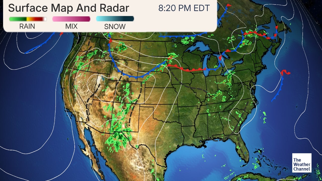
A low pressure system brewing over the Southern Plains States may intensify into a winter storm as it tracks over Southern Ontario Tuesday. Snow is expected to arrive Tuesday morning. The snow may change to ice pellets and freezing rain for a few hours Tuesday before changing back to snow by Tuesday night as colder air arrives in the wake of the low pressure system. Snow will taper off to flurries Wednesday.
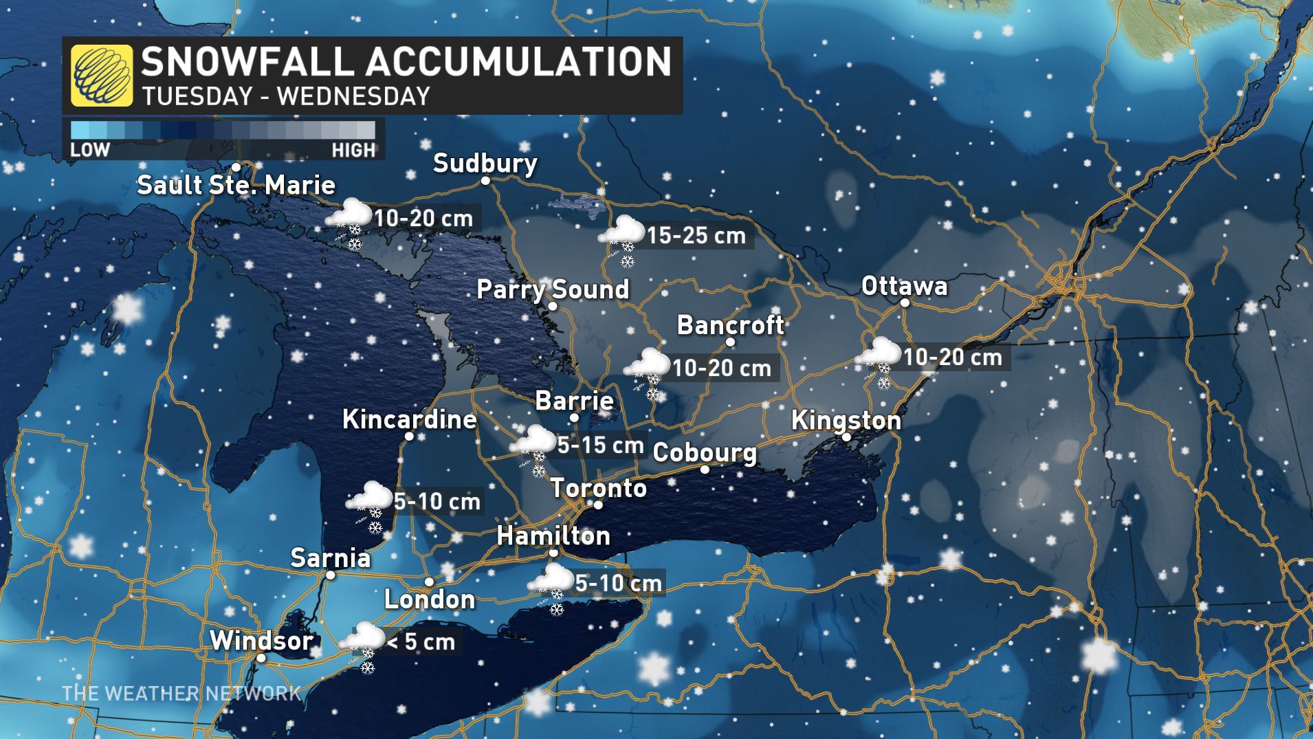
How much snow and freezing rain a region receives will depend on the exact track of the low. Total snowfall and ice pellet amounts of 5 to 15 cm are possible, along with ice buildup from freezing rain. Snowfall amounts may be higher should the switch over to freezing precipitation not occur.
Strong and gusty easterly winds may cause low visibility in blowing snow before the snow changes over to freezing precipitation.
This weather system may have a significant impact on travel.
Watches and warnings may be required as this event draws closer.
Please continue to monitor alerts and forecasts issued by Environment Canada. To report severe weather, send an email to ONstorm@canada.ca or tweet reports using #ONStorm.
11:33 AM EST Sunday 10 February 2019
Special weather statement in effect for:
City of Toronto
Winter storm with significant snow, freezing rain, and strong winds threatening Tuesday.
A low pressure system brewing over the Southern Plains States may intensify into a winter storm as it tracks over Southern Ontario Tuesday. Snow is expected to arrive Tuesday morning. The snow may change to ice pellets and freezing rain for a few hours Tuesday before changing back to snow by Tuesday night as colder air arrives in the wake of the low pressure system. Snow will taper off to flurries Wednesday.
How much snow and freezing rain a region receives will depend on the exact track of the low. Total snowfall and ice pellet amounts of 5 to 15 cm are possible, along with ice buildup from freezing rain. Snowfall amounts may be higher should the switch over to freezing precipitation not occur.
Strong and gusty easterly winds may cause low visibility in blowing snow before the snow changes over to freezing precipitation.
This weather system may have a significant impact on travel.
Watches and warnings may be required as this event draws closer.
Please continue to monitor alerts and forecasts issued by Environment Canada. To report severe weather, send an email to ONstorm@canada.ca or tweet reports using #ONStorm.
")